

Above: At 8,751 feet, Guadalupe Peak is the highest point in Texas and the end of the Guadalupe Ridge Trail, which begins in New Mexico. Photographs by Michael DeYoung.
IT WAS LATE, maybe too late, and now the sun was dropping behind the Guadalupe Mountains. As shadows spread over pine forests high on the eastern slopes, a sense of doubt crept onto the trail.
Like the range itself, my path into the Guadalupes had risen near the southern edge of New Mexico, south of Carlsbad and east of El Paso. For about three hours, I’d been following a footpath identified on maps as the Camp Wilderness Ridge Trail, a segment of a new 100-mile-long super route called the Guadalupe Ridge Trail.
I’d been expecting to reach the state line with daylight to spare. So where was Texas? Over the next peak? Or the one beyond? It was my third day exploring the Guadalupes, and I had yet to see another human. Now darkness was coming to this lonesome country.
Clouds swept across the sky. The trail circled the nearest summit, cinching the mountainside like a belt. Here and there, the striking red bark of the madrone trees was peeling like paper, as it does each fall. Pale blue agaves with red-tinged thorns studded the grassier pitches.
Around the mountain, the trail emerged from stands of piñon, ponderosa, and juniper approaching a windswept ridge—without a doubt, Wilderness Ridge. Here the shadows were banished in the last rays of golden light. A barbed-wire fence interrupted the scene, however, separating me from the edge. A fence? Way up here? It stretched through the yucca and the creosote in either direction, as far as one could see, and seemed out of place here, a testament to the human effort to parcel and order our wildest of terrains. Then I noticed another oddity: an old turnstile in the middle of the fence. Next to it, in capital letters, a faded sign read, boundary line. I pushed the turnstile. It was made of wire and welded pipe, which creaked and groaned as I took a step and straddled the states: one foot in New Mexico, the other in Texas.
On the other side, the world opened onto a staggeringly vast canyon. Bathed in the glow of the setting sun, I found a seat on a limestone ledge above a dizzying plummet of approximately 1,600 feet. A silvery ribbon of McKittrick Creek snaked along the canyon floor. Across the chasm, a darker and somehow even steeper landscape appeared to erupt into dozens of peaks, palisades, and craggy ridges. Many were fringed with the silhouettes of conifers, likely Douglas firs. More common to the northern Rockies, the firs can find purchase here only at higher elevations, on so-called sky islands in the desert. In that moment, it was clear the four miles I’d already hiked—not to mention the hours of night trekking that lay ahead—were more than worth the effort. A gap in the mountains revealed the badlands of the surrounding Chihuahuan Desert, many miles to the southwest and several thousand feet below.
Read more: 9 Ways to Enjoy Carlsbad.
TWO STATES, ONE MOUNTAIN RANGE: “Nature doesn’t follow those boundaries,” says Michael Haynie, a longtime ranger for Guadalupe Mountains National Park. The Guadalupe Ridge Trail is stark evidence of that truth. Pieced together from several existing trails, the GRT begins near the depths of New Mexico, not far from the entrance to Carlsbad Caverns National Park, and ends along the top edge of West Texas, straight east of El Paso, at Guadalupe Peak, which at 8,751 feet is the highest summit in the Lone Star State.
The trail connects Carlsbad Caverns and Guadalupe Mountains National Parks via the Lincoln National Forest, most famously the site of Sitting Bull Falls, which tumbles from a spring-fed creek over a mossy, 150-foot-high canyon wall. An oasis flowing year-round, it fills clear pools where visitors come to relax, wade, and cool down in an otherwise desolate stretch of New Mexican desert. If you’ve been hiking for nearly a week on the Guadalupe Ridge Trail, you’ve certainly earned a dip and drink from the falls.

Above: Trail delights include delicate wildflowers.
In May 2018, the U.S. Department of the Interior named Guadalupe Ridge a national recreation trail, a federal designation meant to promote the use and care of the nation’s most significant pathways. Out of 19 trails approved last year, the GRT is by far the longest and is the only one that crosses state lines. “It offers you a chance to truly make a trek, an extended trip,” Haynie says. “We’re in a remote area of West Texas and New Mexico, so it’s a great way to see some of the last vestiges of wilderness in this country. You can experience the whole range of the Guadalupe Mountains in all its diversity.”
Read more: Scale Five Peaks in One Week on This Epic West Texas Road Trip.
Or, for something less arduous, you can explore pieces of the trail. Particularly popular is a stroll through McKittrick Canyon when the leaves of bigtooth maples burst into spectacular hues of orange, red, and gold in the fall. For decades in the 20th century, a Kansas native named Wallace Pratt enjoyed access to the best view of this autumnal explosion from the front porch of his rustic cabin deep within the canyon. Pratt, the first geologist for Humble Oil, a precursor to ExxonMobil, had first visited the Guadalupes in 1921. Enchanted, he soon began purchasing land in and around McKittrick Canyon and eventually acquired 5,632 acres of desert, canyon, and mountain for family getaways and, beginning in 1949, his full-time residence. Around 1960, Pratt and his family donated the land to the National Park Service to found Guadalupe Mountains National Park, which was established in 1972.
Across the state line from the Pratt cabin, the trail ambles past hidden caves that pock the Lincoln National Forest. You can climb down into them (after you secure a free permit from the Forest Service’s Guadalupe district office, in Carlsbad), or you can climb up the steel steps of an antiquated lookout tower where Forest Service employees once spent long days watching for wildfires along the ridges and canyons and out across the desert. And, of course, Carlsbad Cavern is one of the world’s most famous caves. More than 1,000 feet deep, it is home to the Big Room, the largest underground chamber in the nation. Really, the entire mountain range is a world-class treasure: The range was formed by the largest exposed fossilized reef on the planet, a remnant from a time when the region was submerged by a vast sea.
In much more recent history, the Guadalupe Mountains became the last stronghold of the Mescalero Apaches. Pushed into the mountains from their traditional homes on the Southwestern plains, they hunted elk and other big game and harvested plants—particularly the agave, which provided both food and fiber for ropes, blankets, and sandals. Dotting the mountainsides of the Guadalupes, agave is also known as mezcal, hence the name the tribe was given by neighboring Apache bands and Spanish colonists. Although the Mescalero people were driven out of the mountain range in a series of brutal skirmishes with U.S. soldiers and cavalry troops in the late 1800s, the tribe revisits the Guadalupes every year to harvest agave for ceremonial purposes. Guadalupe Mountains National Park—GUMO to those in the know—comprises more than 86,000 acres of mountain and desert on the Texas side of the state line. More than 60 percent of the park is designated wilderness, which can be experienced only via hiking or riding a horse. More modern forms of transportation like cars and bicycles are not allowed. In other words, get ready for a lot of walking.

Above: A metal obelisk marks the summit of Guadalupe Peak.
Jennifer Roach was in her early sixties when she joined four friends on probably the first through-hike of the Guadalupe Ridge Trail. The group, which Roach describes as experienced hikers—“not youngsters”—from the nonprofit Highpointers Foundation, had been invited by parks officials to test the trail in April 2016.
“You’re up in the trees, you’re down in the canyons,” Roach says. “It was cold. It was hot. It was windy. It snowed heavily on us one day. You name it, we had it. I’d do it again in a heartbeat. I loved it. I thought it was great.”
Roach, who lives in Montrose, Colorado, and her friends took six days to cover 75 miles. “The scenery was just outstanding,” she says. “It was very hilly. Climbing down, it was springtime, so we were beginning to have wildflowers and cactus blooming and budding and greening up, and I was kind of enchanted with it. We all were.”
Read more: Trails in Guadalupe Mountains Gain Federal Recognition.
Water is the major complication for through-hikes. Although there is some water to be found near the trail in the national forest, there is none available in the backcountry of the national parks. At a recommended one gallon of water per day, a hiker would have to carry seven gallons for a weeklong trek. Not likely. Rangers from the parks and the Forest Service hope that someday a private outfitter will provide a water-caching service, ensuring that hikers will be able to quench their thirst along the trail. I was unable to find anyone to cache water for me, so I ended up seeing the GRT in sections.
For anyone considering a full-length expedition, Roach recommends taking extra care to research maps and talk with knowledgeable rangers beforehand. “I think that would be prudent anytime, but especially on this hike, because you don’t always know. It would be easy to take the wrong trail or get lost,” she says. “Because it is still so new, not a lot of people are doing it.”
THE GUADALUPES ARE NOTORIOUS for extreme swings in the weather, as Roach attests. Summiters of Guadalupe Peak describe blasting wind gusts in excess of 80 miles per hour. Then you head down from the mountains and bake in the desert.
It was getting warmer by the minute one sunny day last October when I turned off the Guadalupe Ridge Trail at the historic Dark Canyon lookout tower.
The Forest Service locks the door that accesses the cab of the tower, but you can still climb high enough for panoramic views of the surrounding juniper-studded canyonlands. At the tower’s base, there’s also a locked red cabin built by the Civilian Conservation Corps during the Great Depression.
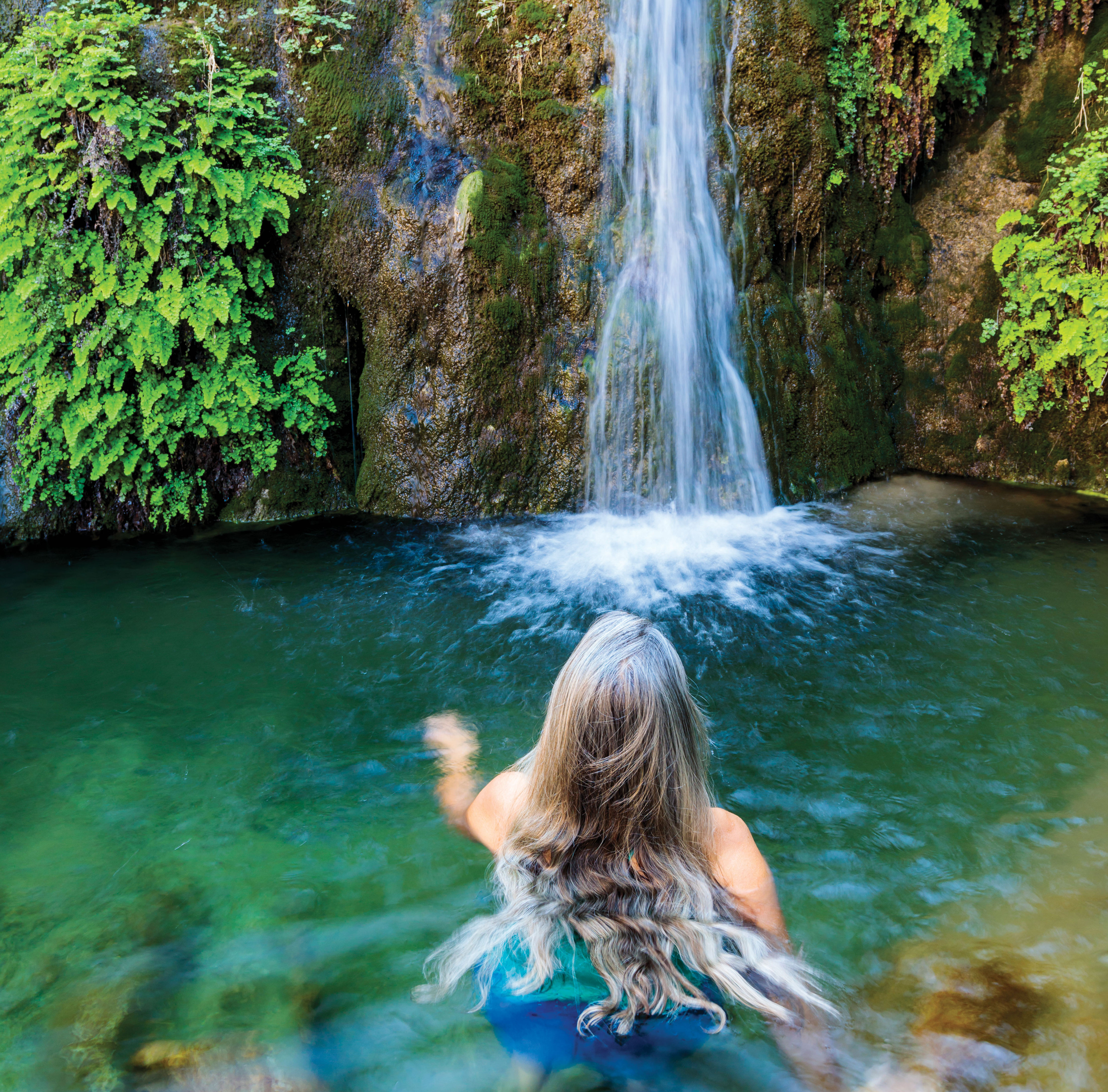
Above: Sitting Bull Falls, an oasis near Carlsbad, rewards weary hikers.
Next to the tower and cabin, a narrow footpath leads away from the main trail and out of the high desert’s ubiquitous juniper forests and into a golden sea of bunchgrass. The grass swayed in the breeze as the path descended over small red rocks that loosened and slid underfoot as I tried to keep up with a lanky Forest Service ranger named Aaron Stockton.
Few people know the Guadalupes as intimately as Stockton does. A Carlsbad native, he’s spent years wandering the range’s many public trails and has rappelled into nearly impossible-to-access canyons. But his first love here is the caves: Stockton is both the cave specialist and the district ranger (essentially, the supervisor) of the Guadalupe Ranger District of the Lincoln National Forest.
Read more: Return to the Guadalupes—photographing fall's arrival in the Guadalupe Mountains.
“Caves really give this area its identity, in my opinion,” Stockton says. “We have people from all over the world, literally, who come here to see our caves.”
Stockton is walking and talking—whispering, really—as the trail ends and we enter the mouth of Cottonwood Cave, which is situated on the side of a cliff about a quarter mile from the lookout tower. Daylight streams into the cave’s entrance, illuminating the roughly eroded limestone walls and jagged stalactites that hang like pink icicles from the ceiling.
Cottonwood Cave is about three miles long. It winds past beautiful gypsum flowers and chandeliers, in and out of a room where the ceiling is 250 feet tall, and through a nine-inch squeeze that opens to a mile-long passage. “It’s just crazy,” Stockton says. “It gets to all these pretty rooms. Every section’s different.”
The cave floor crunches underfoot as Stockton feels his way around a tall formation known as the Praying Nun. “This is usually where you have to turn on your light, but it just keeps going,” he says. Then he stops and grows quiet for a moment. “I like to just listen to the sounds of it, you know? You hear the squeaking? That’s bats.” He could also hear the steady drip of water somewhere in the darkness.

Above: El Capitan was formed by an ancient limestone reef and is the southernmost point of the Guadalupe Mountains.
“This is my favorite cave that I’ve caved in,” Stockton says. “And I’ve caved in most states that have caves.”
Along with its caves and access to water, Stockton notes another distinction between the Lincoln National Forest section of the GRT and the national parks found on either side of it: You can drive most of this portion of the trail with a high-clearance, four-wheel-drive vehicle. “You still get this magnificent scenery,” Stockton says, “but it’s open to a wider group of folks, and I think that’s pretty neat.”
Read more: Carlsbad Caverns Reveal More of Their Secrets.
Not that you’re likely to see any vehicles on the trail. An escape from crowds and traffic is a pretty solid reason to get lost where Texas and New Mexico meet. Here, the distinction between the states would blur and disappear if not for a barbed-wire fence strung through the mountains. Thankfully, it has a turnstile that allows you to keep wandering seemingly forever. “If you can cache your water and spend days out there, you can absorb so much more of the wilderness experience,” Haynie says. “You’re crossing boundaries.”
The night when I came to the edge of Wilderness Ridge, I sat for a while on the limestone perch above McKittrick Canyon. It was overwhelming to take in the enormity and isolation still found in this less-traveled region of the world. The last rays of sun disappeared and the air cooled as night fell. I rustled a headlamp from my pack, flipped the switch, and found my way back to the trail. It winds through a range that knows no bounds.